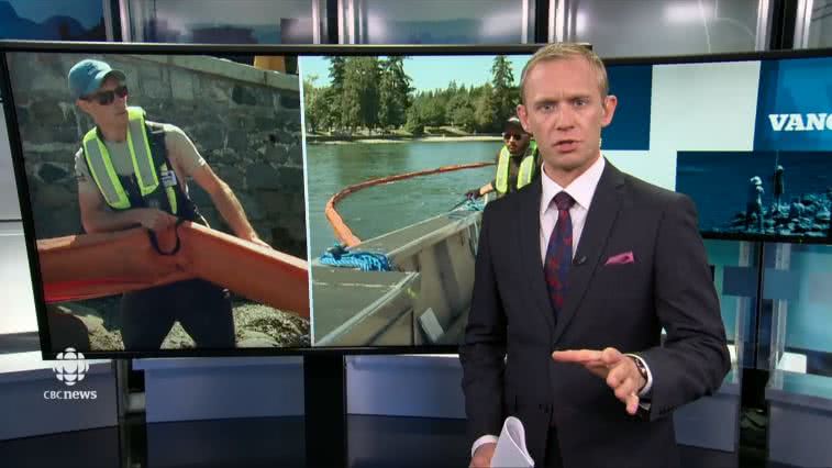
As part of WCMRC’s Coastal Protection Program, SC crews were out field testing Geographic Response Strategies along the shoreline at Stanley Park east of First Narrows and in Coal Harbour this week.
The City of Vancouver Fire and Rescue’s fire boat was on hand and received spill response training from WCMRC. Squamish Nation and Tsleil-Waututh Nation representatives also participated to ensure protection of culturally sensitive sites.
CBC & CityTv camera crews documented the deployments.
- To watch the CBC story online click here. (WCMRC story starts at 24:00)
- To watch the Breakfast Television story online click here. (WCMRC story starts at 4:54)
- To read the CBC story online click here.
Coastal Protection Program
WCMRC’s Coastal Protection Program identifies and develops oil spill protection strategies for coastal sensitivities along Canada’s West Coast. To date, WCMRC has produced nearly 400 protection strategies called Geographic Response Strategies (GRS) for the Salish Sea, the south and the north coast. The aim is to map the sensitivities for all 27,000 kilometres of the coast. WCMRC is grateful for the participation of the many coastal communities and First Nations who have already participated in the program.
Geographic Response Strategies
As part of Transport Canada’s move towards risk-based area planning, WCMRC has designed a digital mapping application to coordinate our GRSs for the coast. The mapping project involves identifying coastal resources that are at risk if a spill occurs nearby. Sensitivities include ecological, biological, cultural and economic resources. Once sensitive resources have been identified, WCMRC develops booming strategies to protect them. These two-page documents identify anchor locations for boom, logistical considerations, equipment and personnel requirements. The objective of a GRS is to reduce decision making time during the initial response to a spill and help identify potential equipment needs.
The information for the sensitivities is collected from existing data sets including the provincial Coastal Resource Information System (CRIMS) and Remote Access to Archaeological Data (RAAD). The development process includes field testing by WCMRC response crews and validation by registered biologists and archaeologists. The participation of First Nations, emergency planners and community subject matter experts as helped to identify gaps and new sensitivities.