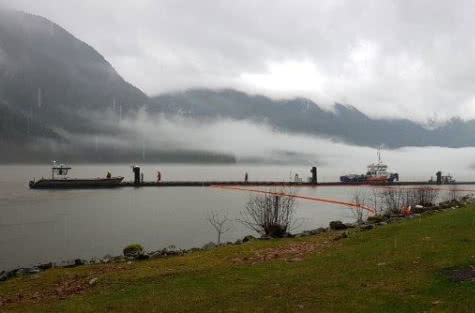
WCMRC crews spent several days of field work developing protection and response strategies for Cates Park and Indian Arm. The work is part of WCMRC’s Coastal Response Program and included participation from Tsleil-Waututh Nation, WCMRC’s Response Readiness team and South Coast Operations.
Geographic Response Strategies (GRS)
As part of Transport Canada’s move towards risk-based area planning, WCMRC has designed a digital mapping application to coordinate our GRSs for the coast. The mapping project involves identifying coastal resources that are at risk if a spill occurs nearby. Sensitivities include ecological, biological, cultural and economic resources. Once sensitive resources have been identified, WCMRC develops booming strategies to protect them. These two-page documents identify anchor locations for boom, logistical considerations, equipment and personnel requirements. The objective of a GRS is to reduce decision making time during the initial response to a spill and help identify potential equipment needs.
Coastal Response Program
WCMRC’s Coastal Response Program identifies and develops oil spill protection strategies for coastal sensitivities along Canada’s West Coast. To date, WCMRC has produced nearly 400 protection strategies called Geographic Response Strategies (GRS) for the Salish Sea, the south and the north coast. The aim is to map the sensitivities for all 27,000 kilometres of the coast. WCMRC is grateful for the participation of the many coastal communities and First Nations who have already participated in the program.